Snagging on IFC
without outdated PDF snapshots
Use IFC as a 2D map
Traditionally, snagging involves using a PDF snapshot of the current situation, but we've taken it to the next level. With our innovative solution, you can use the IFC as the 2D map, ensuring that you're always working with the latest and most accurate information.
Read more about Snagging in this free whitepaper 
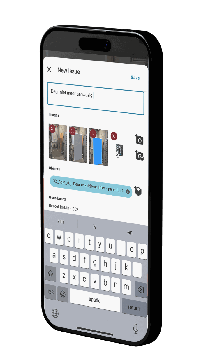
Make pictures of issues
Bring your architectural plans and BIM models to the construction site, generate lists of issues needing attention with accompanying images and remarks directly from your smartphone or tablet, and promptly share them with your subcontractors.

Integration
You can also integrate various file formats such as Revit, IFC, Navisworks, PDF, and DWG into a unified interface, allowing you to view 2D drawings alongside 3D models directly on-site using your mobile device.
Space management
All spaces, space numbers and space usage data durable under control. Enrich data optionally with parameters like floor type or wall finishing.
Asset Management
All assets durable under control, so you can truly perform planned maintenance. Control your data and be less dependant on your contractor.
Our clients: